Vangara, Srikakulam
Appearance
Vangara | |
|---|---|
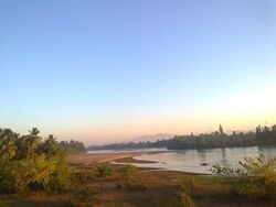
 Nagavali River at Chinna Rajulagumada village of Vangara mandal | |
 Dynamic map | |
| Coordinates: 18°37′01″N 83°36′32″E / 18.617°N 83.609°E | |
| Country | India |
| State | Andhra Pradesh |
| District | Vizianagaram |
| Talukas | Vangara |
| Elevation | 132 m (433 ft) |
| Population (2001) | |
| • Total | 1,653 |
| Languages | |
| • Official | Telugu |
| Time zone | UTC+5:30 (IST) |
| Vehicle Registration | AP30 (Former) AP39 (from 30 January 2019)[1] |
| Nearest city | Rajam |
Vangara is a village in Vangara Mandal in Vizianagaram district of the Indian state of Andhra Pradesh. It is located in Vangara mandal of Palakonda revenue division.[2]
Demographics
[edit]Telugu is spoken here. The population is 1,653—824 males and 829 females in 355 dwellings. The area is 248 hectares (610 acres).
References
[edit]- ^ "New 'AP 39' code to register vehicles in Andhra Pradesh launched". The New Indian Express. Vijayawada. 31 January 2019. Archived from the original on 3 February 2019. Retrieved 9 June 2019.
- ^ "Mandal wise list of villages in Srikakulam district" (PDF). Chief Commissioner of Land Administration. National Informatics Centre. Archived from the original (PDF) on 8 December 2014. Retrieved 6 March 2016.


